Menggapai Atap Celebes: Catatan Perjalanan Pendakian Gunung Latimojong
Bel berbunyi, tanda waktu istirahat di tengah jam pelajaran tanda untuk seluruh siswa menutup sementara jam pembelajaran ketika di sekolah. "Bro, tahun baru nih, ayo naik gunung," Ucap seseorang, saat saya sedang tertidur di masjid, merebahkan tubuh sementara di jam istirahat. "Ke mana?" saya bertanya kepada Argo, salah satu "teman seperjuangan" yang sudah pernah mendaki gunung bersama beberapa kali. "Latimojong, Sulawesi," jawabnya penuh semangat. Tanpa berpikir dua kali, saya langsung setuju untuk mendaki Gunung Latimojong sekaligus libur sekolah dan menyambut tahun baru 2017 beberapa hari lagi.
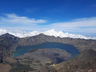
Gunung Latimojong adalah salah satu nama gunung yang terletak di Kabupaten Enrekang, Sulawesi Selatan, Indonesia. Gunung ini terletak di bagian tengah Sulawesi Selatan, dengan sebagian besar wilayahnya berada di kawasan Kabupaten Enrekang. Latimojong merupakan gunung tertinggi di Pulau Sulawesi, dengan puncak bernama Bulu Rante Mario yang memiliki ketinggian 3.478 meter di atas permukaan laut (mdpl). Pegunungan Latimojong membentang dari selatan ke utara. Di sebelah barat berbatasan dengan Kabupaten Enrekang, di sebelah utara dengan Kabupaten Tana Toraja, di sebelah selatan dengan Kabupaten Sidenreng Rappang, sementara seluruh wilayah timurnya merupakan Kabupaten Luwu hingga ke pesisir Teluk Bone.

Foto bersama di pucak Gunung Latimojong, puncak Rente Mario dengan ketinggian 3.478 mdpl
Perjalanan Menuju Basecamp Pendakian
Kami berenam (saya, Argo, Wahyu, Duni, Kar, dan ayah Argo) berangkat menggunakan pesawat dari Bandara Soekarno-Hatta, Jakarta, menuju Bandara Sultan Hasanuddin, Makassar. Untuk mencapai basecamp Gunung Latimojong di Kabupaten Enrekang, kami harus menempuh perjalanan panjang dari Kota Makassar ke Kecamatan Baraka. Kami menggunakan mobil sewaan yang sudah dipesan sebelumnya (banyak penyedia jasa travel menawarkan biaya sekitar 1–2 juta rupiah, tergantung negosiasi). Perjalanan memakan waktu sekitar 7 jam hingga tiba di Kecamatan Baraka. Kami sampai pada sore hari dan langsung beristirahat setelah membersihkan diri serta merapikan barang-barang untuk perjalanan keesokan harinya.

Tim pendakian berangkat menuju Makassar
Salah satu momen paling berkesan dalam perjalanan ke Gunung Latimojong adalah saat kami menumpang mobil jeep menuju Desa Karangan. Jalan berliku serta tanjakan dan turunan menemani perjalanan kami di atas mobil tersebut, sambil memandangi hamparan perbukitan Enrekang. "Hajarrr... hajarrr... eaaa!" teriak sopir asal Sulawesi sambil menyemangati mobil jeep yang kami tumpangi melewati jalan rusak dan berlumpur. Beberapa jam kemudian, kami melanjutkan perjalanan dengan berjalan kaki hingga tiba di Desa Karangan. Di sinilah para pendaki biasanya beristirahat sambil menyiapkan perlengkapan di basecamp, sebuah rumah panggung milik salah satu warga Desa Karangan. Kami bermalam di Desa Karangan untuk menyiapkan logistik pendakian, karena esok pagi kami akan mulai mendaki Gunung Latimojong.

Menggunakan mobil sejenis jeep untuk menuju Desa Karangan

Pintu masuk ke Desa Karangan

Sebelum memulai pendakian, tim mengambil foto di rumah penduduk
Perjalanan dari Basecamp hingga Tempat Mendirikan Tenda
Pagi harinya, setelah sarapan dan pemanasan, kami mulai mendaki dari Desa Karangan menuju Pos 1. Jaraknya cukup singkat, hanya sekitar 2 kilometer (km) dengan waktu tempuh sekitar 90 menit. Medannya berupa jalan aspal dan tanah, diapit rumah-rumah warga di kanan dan kiri, lalu melewati ladang penduduk di sepanjang jalan. Jalur pendakian ini cukup baik dan bisa dilalui kendaraan bermotor—para petani desa biasanya menggunakan jalur ini untuk pergi ke ladang. Sapaan hangat pun terjalin antara kami dan warga setempat di pagi itu.

Pemandangan Pegunungan Latimojong saat sampai di Pos 1
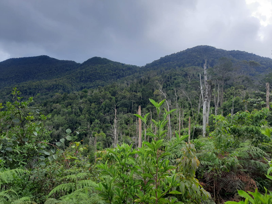
Perjalanan dari Pos 1 ke Pos 2 memakan waktu sekitar 2 jam dengan jarak tempuh hingga 3 km dan mulai memasuki hutan dengan vegetasi yang rapat. Tanda bahwa kita sudah mendekati Pos 2 adalah suara aliran sungai yang mulai terdengar jelas, serta adanya jembatan yang harus dilewati. Begitu tiba di Pos 2, para pendaki akan disambut oleh sebuah gua yang biasa disebut Gua Pa'Pak. Air terjun di Pos 2 ini menjadi sumber air utama bagi para pendaki yang melewati jalur ini.

Jembatan kayu and Gua Pa'Pak dibelak foto

Untuk mencapai Pos 3, kami hanya membutuhkan waktu sekitar 50 menit dengan jarak tempuh kurang lebih sekitar 1,5 km. Namun, jalur menuju pos ini cukup menantang dan menguras tenaga karena medannya yang terjal. Di Pos 3 tidak ada sumber air hingga Pos 5, sehingga kami harus berhemat dengan persediaan air yang dibawa. Kami beberapa kali berhenti untuk mengatur napas agar tidak cepat kelelahan.

Jalur menuju Pos 3 yang melewati tanjakan terjal dan dibantu tali pengaman
Perjalanan ke Pos 4 terasa lebih ringan dengan beberapa jalur landai, meski ada juga bagian yang cukup menanjak. Waktu tempuh kami sekitar 60 menit dengan jarak 1 km, dengan hutan yang mulai dipenuhi lumut.
Selanjutnya, untuk mencapai Pos 5, kami harus berjalan selama 120 menit dengan jarak sekitar 2 km. Kaki kami semua terasa pegal dan mulai kram—wajar saja, karena jalur pendakian Gunung Latimojong memang didominasi oleh tanjakan yang hampir di setiap jalur tanpa henti. Begitu tiba di Pos 5, kami segera mendirikan tenda karena hujan mulai turun. Pos 5 menjadi tempat ideal untuk berkemah karena lahannya cukup luas dan terdapat sumber air. Setelah makan malam, kami segera beranjak tidur karena esok pagi kami harus melanjutkan perjalanan menuju puncak Gunung Latimojong. Rante Mario, kami datang!
Summit Attack: Menggapai Titik Tertinggi Pulau Sulawesi
Saya memaksakan diri melawan udara dingin dan rasa kantuk yang masih menggantung di mata. Setelah menyiapkan beberapa perlengkapan yang akan dibawa ke puncak, kami melanjutkan perjalanan. Menuju Pos 6, kami disambut oleh hutan lumut yang memppesona, khas Gunung Latimojong. Jalurnya cukup menanjak dengan estimasi waktu tempuh sekitar 90 menit dan jarak sekitar1,5 km. Begitu pula menuju Pos 7—perjalanan akan dihiasi hutan lumut yang indah dan cocok dijadikan spot foto.

Hutan lumut dengan pemandangan pegunungan Latimojong

Menuju puncak di pagi hari
Setelah perjalanan panjang, kami akhirnya tiba di puncak Gunung Latimojong. Tanda bahwa kita telah mencapai puncaknya adalah sebuah batu besar bertuliskan "Rante Mario 3478 MDPL". Sebelumnya, saya tidak pernah membayangkan akan mendaki gunung di luar Pulau Jawa. Mungkin ini muncul dari rasa ingin tahu untuk mencari sensasi mendaki gunung yang berbeda—karena setiap gunung memiliki ciri khas dan keunikannya masing-masing. Namun yang pasti, menjadi kewajiban kita semua untuk menjaga seluruh kekayaan alam yang ada di bumi ini, karena semua itu adalah amanah untuk anak cucu kita di masa depan.


Komentar
Posting Komentar